ΕΘΝΙΚΟ ΜΕΤΣΟΒΙΟ ΠΟΛΥΤΕΧΝΕΙΟ | ΣΧΟΛΗ ΑΡΧΙΤΕΚΤΟΝΩΝ - ΜΗΧΑΝΙΚΩΝ
ΑΡΧΙΤΕΚΤΟΝΙΚΗ ΑΝΑΛΥΣΗ ΠΑΡΑΔΟΣΙΑΚΩΝ ΚΤΗΡΙΩΝ ΚΑΙ ΣΥΝΟΛΩΝ
ΠΡΟΓΡΑΜΜΑ ΨΗΦΙΟΠΟΙΗΣΗΣ ΔΙΑΤΟΜΕΑΚΟΥ ΜΑΘΗΜΑΤΟΣ 5ΟΥ ΕΞΑΜΗΝΟΥ
Ανω Καστανιά
Main street Facade
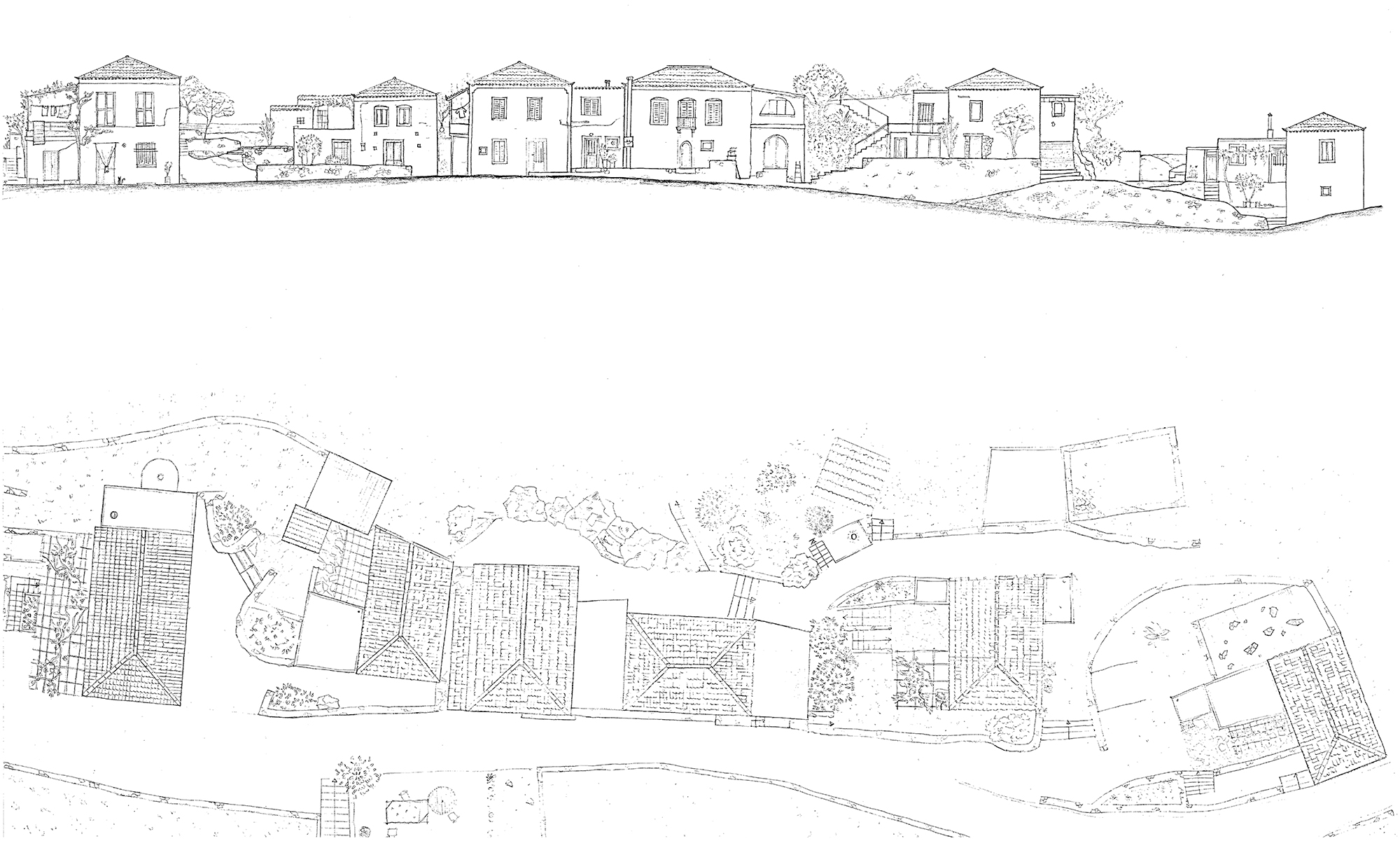
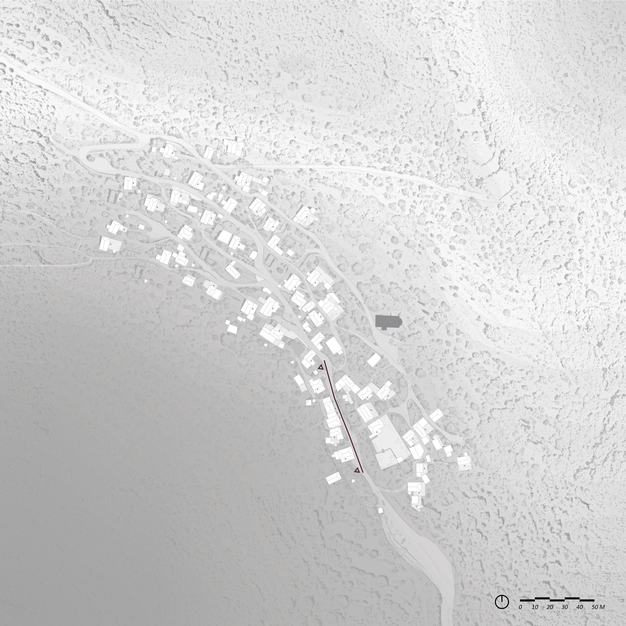


We have chosen to represent the main street of the village. This is the main street because it is the way to access all the houses: each inhabitant must use this road to enter or leave the settlement. Indeed, the large car park at the entrance to the village is located to the left of the first house shown (direction of the drawing).
It is also the main street because it is in this street opposite the first three houses that the inhabitants meet to discuss. The old school, now transformed into the town hall and village hall, is below this meeting place.
The olive harvest, which is still at the heart of village life, takes place in the vicinity: several olive trees are located in the courtyard of the old school (town hall) and the bags of olives harvested are stored in the small public square created by the inhabitants. Moreover, the olive harvest is also an opportunity for the inhabitants to get together and practice this common activity (see photographs).
On the elevation one can see a general typology of two-storey houses, and one can read the topography that continues to rise behind these houses.
The plan of these houses tells of the varying relationship of the houses to the road and to the public space, we can also read the different typologies of soil: the main road is asphalt, while the access paths to the houses, the private accesses and the terraces are made of stones. Some are original: stones held together with a kind of mortar, others, more recent, are asphalt paths that have been painted to imitate this stone layout.
The plan also shows any extensions that have been made by the inhabitants over time, and other outdoor features such as arbors on which ruins are grown, again this vegetation provides shade and makes the outdoor space usable.